Evolving Sediment Structure and Lithospheric Architecture Across the Indo‐Burman Forearc Margin From the Joint Inversion of Surface‐ and Scattered‐Wave Seismic Constraints
Christopher J. W. Carchedi, James B. Gaherty, Joseph S. Byrnes, Stéphane Rondenay, Michael S. Steckler, Rasheed Ajala, Patricia Persaud, Eric A. Sandvol, Md. Samiul Alim, Sanju Singha, and Syed Humayun Akhter
Click here for full article
Long duration ~600–500 Ma high-T metamorphism ended with early Ordovician rapid intermediate-T cooling and stabilization of Sri Lanka in central Gondwana
Daniel K. Holm, Inoka Widanagamage, Nelia Dunbar and Matthew Heizler
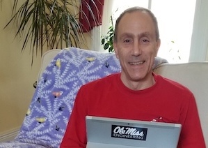
Impact of Covid-19 on Education Not Going Away, UM Study Finds
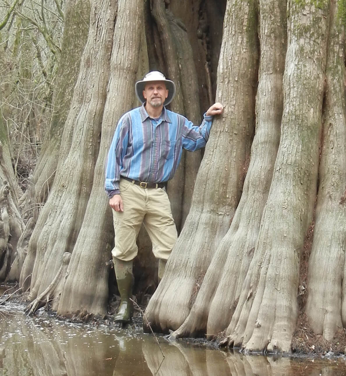
by Gregg Davidson, Hong Xaio, and Kristin Davidson
Read the full journal article here.
UM alum Zachary Lepchitz and his work with the US Department of Energy
Development of a HAND-based flood risk assessment tool in Google Earth Engine for a data-scarce region in the US – ScienceDirect
by Jobin Thomas, Subhami Mohan, Thomas Oommen, and Navin Tony
Despite the decreased disaster resilience of rural communities in the Great Lakes region to flooding, flood mitigation efforts have been impeded by inadequate data and lack of appropriate tools for understanding flood risk. Development of such resources often requires data and computationally intensive approaches, which are challenging in data-scarce conditions. This study presents the development of a web application in Google Earth Engine (GEE) for flood risk assessment. The application utilizes the Height Above the Nearest Drainage (HAND) model and synthetic rating curve (SRC) for fluvial flood inundation modeling, the Simulating WAves Nearshore (SWAN) model for coastal flood inundation modeling, the United States Geological Survey (USGS) regional regression equations for estimating peak discharge, and depth-damage functions of the HAZUS-MH flood model for estimating losses due to building-level impacts. The GEE-based geospatial web application, which is operational across five counties in the Western Upper Peninsula (WUP) of Michigan, fulfills the requirement of the community and decision-makers to assess the risks caused by flooding in the region. We demonstrated the applicability of the tool in the Ontonagon River, Michigan, and the results indicate the suitability of the platform for implementing decisions, long-term planning, and understanding flood risk with a reasonable degree of accuracy.
Collapse of Pre-COVID-19 Differences in Performance in Online vs. In-Person College Science Classes, and Continued Decline in Student Learning
Click here to read full article.
Bedrock Origins from Petrology and Geochemistry
Bedrock Origins from Petrology and Geochemistry: Volcanic Gravel Clasts from the Rawhide Terrace in the Pleistocene Ancestral Mississippi River Pre-Loess Terrace Deposits
Click here to read full article.
Assessing Differences in Groundwater Hydrology Dynamics Between In Situ Measurements and GRACE-Derived Estimates via Machine Learning: A Test Case of Consequences for Agroecological Relationships Within the Yazoo–Mississippi Delta (USA)
Click here to read full article.
Integrating ERT and SP Techniques for Characterizing Aquifers and Surface-Groundwater Interactions
Click here to read full article.
Predicting USCS soil texture classes utilizing soil spectra and deep learning


Anush Kumar Kasaragod· Jobin Thomas· Thomas Oommen· Ryan Williams· Sidike Paheding·Abel Reyes Angulo· Jordan Ewing· Michael Cole· Paramsothy Jayakumar
Click here to read full article.
Horizon-assisted lithologic modeling: understanding Mississippi Embayment
Addressing the Effect of Intra-Seasonal Variations in Developing Rainfall Thresholds for Landslides: An Antecedent Rainfall-Based Approach
Vishnu, C.L.; Oommen, T.; Chatterjee, S.; Sajinkumar, K.S. Addressing the Effect of Intra-Seasonal Variations in Developing Rainfall Thresholds for Landslides: An Antecedent Rainfall-Based Approach. GeoHazards 2024, 5, 634-651. https://doi.org/10.3390/geohazards5030033
Click here to read full article.
Horizon-assisted lithologic modeling: understanding Mississippi Embayment and Coastal Lowlands aquifer systems in Louisiana and southwestern Mississippi, USA
Yang, S., Tsai, F.TC. & Yarbrough, L.D. Horizon-assisted lithologic modeling: understanding Mississippi Embayment and Coastal Lowlands aquifer systems in Louisiana and southwestern Mississippi, USA. Hydrogeol J (2024). https://doi.org/10.1007/s10040-024-02804-z
Click here to read full article.
Automated Flood Prediction along Railway Tracks Using Remotely Sensed Data and Traditional Flood Models
Zakaria, A.-R.; Oommen, T.; Lautala, P. Automated Flood Prediction along Railway Tracks Using Remotely Sensed Data and Traditional Flood Models. Remote Sens. 2024, 16, 2332. https://doi.org/10.3390/rs16132332
Click here to read full article.
Need for a Multi-Sensor Monitoring Approach for Embankment Failures: Lessons Learned for the Edenville Dam Failure
Thomas, J., Klida, R., Oommen, T., KS, Sajinkumar., Zhang, B., & Hu, X. (2024). Need for a Multi-Sensor Monitoring Approach for Embankment Failures: Lessons Learned from the Edenville Dam Failure. Environmental & Engineering Geoscience, 30(1-2), 19-30.
Click here to read full article.
PyLandslide: A Python tool for landslide susceptibility mapping and uncertainty analysis
Basheer, M., & Oommen, T. (2024). PyLandslide: A Python tool for landslide susceptibility mapping and uncertainty analysis. Environmental Modelling & Software, 106055.
Click here to read the full article.
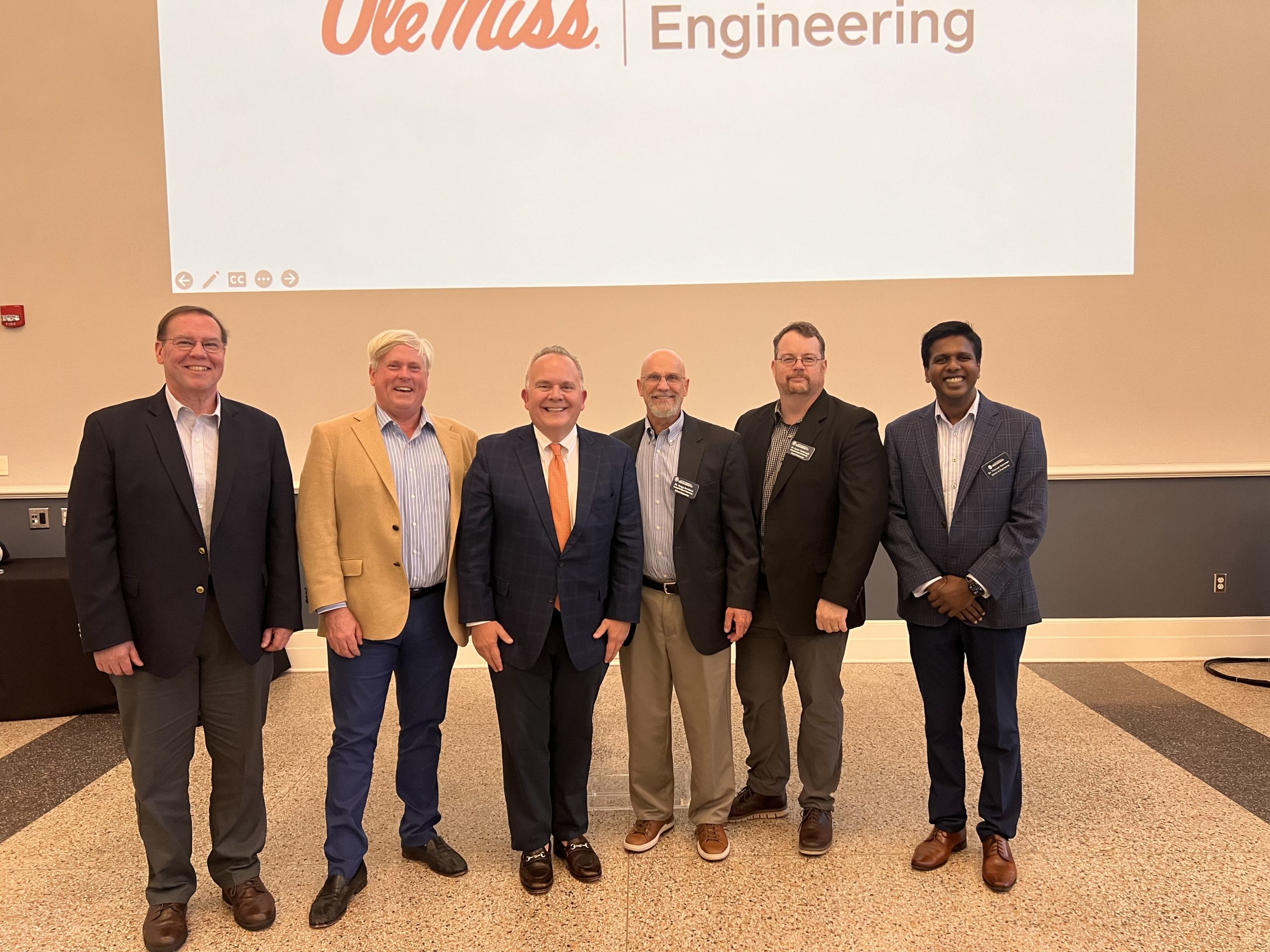
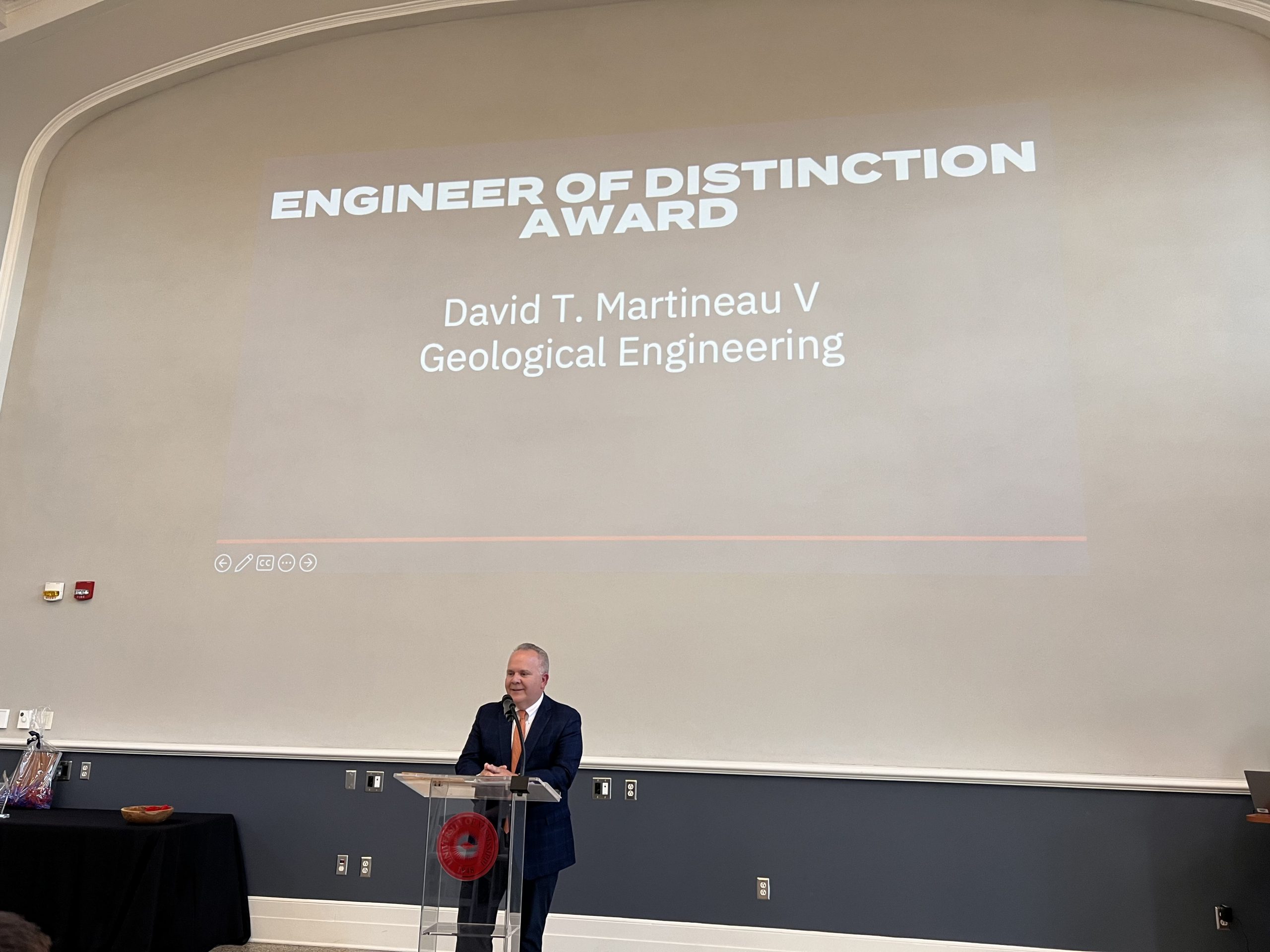
Congratulations to David Martineau for being recognized as the 2024 University of Mississippi
School of Engineering Engineer of Distinction.
David is a 1992 Geological Engineering Graduate and President of Martineau Petroleum, Inc.
Recent publication by emeritus faculty Dr. Lou Zachos
Selective concentration of iron, titanium, and zirconium substrate minerals within Gregory’s diverticulum,
an organ unique to derived sand dollars (Echinoidea: Scutelliformes)
Click here to read the full article.
AEG APPOINTS A NEW CO-EDITOR FOR THE ENVIRONMENTAL & ENGINEERING GEOSCIENCE JOURNAL
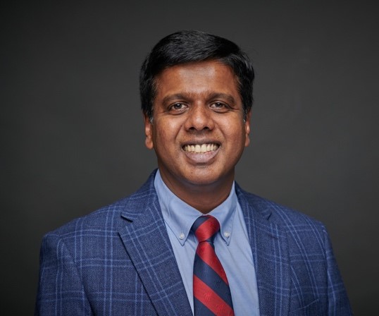
AEG is pleased to announce that Dr. Thomas Oommen, Professor and Chair of Geology and Geological Engineering at the University of Mississippi, has been appointed as co-editor of the Journal Environmental & Engineering Geoscience (E&EG). E&EG is a joint publication of AEG and the Geological Society of America (GSA) and is published quarterly.
Dr. Oommen received his Ph.D. in Geotechnical and Geo-environmental engineering from Tufts University in Medford, Massachusetts. His research is focused on geohazard characterization and risk reduction using remote sensing and artificial intelligence. Dr. Oommen has extensive teaching, research, and consulting experience in geohazards, sustainable development, community resilience, infrastructure monitoring, asset management, engineering geology, and transportation geotechniques. Dr. Oommen has authored two books, 85 journal publications, and numerous conference publications. He has received over 9 million USD in research funding.
Dr. Oommen is a past chair of the GSA Environmental and Engineering Geology division, chair of the American Society of Civil Engineers Engineering Geology and Site Characterization Committee, and the chair of the E&EG Journal editorial advisory board. Dr. Oommen has been a keynote speaker and panelist for several international meetings and conferences.
Dr. Oommen replaces Dr. Abdul Shakoor, who is retiring from his co-editorship of E&EG after 30 years of service.
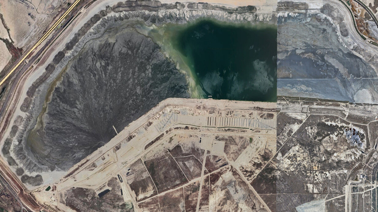
UM Joins National Cohort of Universities Studying Disaster ReadinessOXFORD, Miss. – A University of Mississippi professor has begun studying the impact of mining waste structures as part of a national initiative to improve disaster readiness. The U.S. Department of Commerce’s National Institute of Standards and Technology and the National Science Foundation have awarded more than $7 million in grants to support natural hazard preparedness to 15 universities across the nation, including Ole Miss. Each university will tackle an aspect of disaster readiness, from how to build structures that can survive storm wave impacts to creating damage prediction models for earthquakes, fires and floods. The Disaster Resilience Research Grant allotted nearly $400,000 to Thomas Oommen, UM chair and professor of geology and geological engineering, and Sidike Paheding, assistant professor of computer science at Fairfield University, to study mine tailing impoundments, massive structures that store mining waste. “With the increased interest in green energy and battery technology, the need for critical minerals and mining is increasing,” Oommen said. “That means mine tailings are going to be more and more prevalent, but monitoring these dams is a challenge.” Mining operations leave behind massive amounts of slurry, or solid waste, that is stored behind dams constructed of the same waste material, Oommen said. While some of the materials are harmless – such as rock, sediment and other debris – others are toxic, including arsenic, lead, uranium and other compounds.
The Kennecott tailings dam near Salt Lake City failed in 1941, 1964 and 1998. In a project funded by the National Institute of Standards and Technology, UM professor Thomas Oommen and Sidike Paheding, of Fairfield University, are using satellite imagery and environmental data to develop ways to assess the integrity and safety of mine tailing impoundments to avert such disasters. Submitted photo When these dams fail, a flood of waste has been known to reach more than 6 miles from the dam site, Oommen said. A dam in Brumadinho, Brazil, failed in 2019, sending a wall of waste and mud into a small town more than half a mile away, killing more than 240 people. “Mine tailings dams are really large geotechnical, earthen structures, and they’re prone to failure with extreme weather events,” Oommen said. “The consequences of failure can be catastrophic both in terms of casualties and environmental effects.” Similar failures have happened in Mississippi. In 2005, a phosphate mine tailings dam failure allowed more than 17 million gallons of acidic liquid to pour into surrounding marshland, killing vegetation near Bangs Lake in Jackson County. Some 12,563 mines are active across the United States, but there is no rough count of how many mine tailings dams exist. When mines shut down, oversight of the impoundments often becomes lax, Oommen said. “The challenge is when the mining operation is happening, there is a lot of interest in the dam and its upkeep, but once the operation is done and there is no more revenue being generated, the companies are gone,” he said. “So, who is going to maintain this? Often, it becomes no one’s property or it falls into the hands of the government to maintain it. “So, maintaining and monitoring these tailings dams is a challenge, especially if you have to do it manually, using traditional methods.” Oommen and Paheding’s research will use satellite and environmental data to detect whether a dam is at risk of failure. They will also use historical weather records to determine what correlation, if any, there is between hazardous weather and dam failures. “We need to prevent environmental damage, especially if there are residents living in nearby areas,” Paheding said. “Our goal is to provide a technological solution to prevent these incidents.” Using satellite imagery and environmental data, Paheding and Oommen hope to develop an advanced machine learning model that can identify potential issues, Paheding said. If successful, the technology would allow remote monitoring of mine tailing impoundments and help predict when a dam is becoming unstable, Oommen said. “From my perspective, I hope we can have a sophisticated algorithm that can be utilized to solve this problem,” Paheding said. “We don’t want have something that works in theory; we want to have something applicable in a real-world scenario.” This material is based upon work supported by the National Science Foundation under grant No. 2414588. |
UM Receives Top Honors as a ‘Great College to Work For’
University makes prestigious list for the 14th year
FacebookTwitterLinkedInEmailCopy LinkSMSPrintFriendly
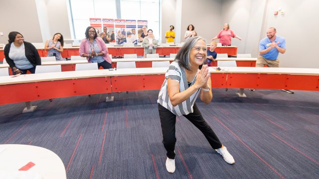
Andrea Jekabsons (center), the university’s chief human resources officer, leads a workplace stretch session for staff members during annual Staff Appreciation Week activities. The university has been named a Great College to Work For again this year and has been recognized as an Honor Roll school in the program. Photo by Srijita Chattopadhyay/Ole Miss Digital Imaging Services
OXFORD, Miss. – The University of Mississippi is once again one of the nation’s “Great Colleges to Work For,” according to The Chronicle of Higher Education.
This is the 14th year that the university has been named a Great College to Work For. Ole Miss joins 42 other Honor Roll schools recognized this year as standouts in their size categories.
“This outstanding distinction of being a great place to work is an incredibly high honor especially our recognition on the Honor Roll and across all 10 categories,” Chancellor Glenn Boyce said. “It really speaks to the culture of caring and collaboration that permeates our campus community.
“Our tremendous people deeply believe in and support our mission, which makes this university a truly special place to live, work and learn.”
The results were released Monday (Sept. 11) in a special insert of The Chronicle. Of the 194 institutions participating in 2023, 72 were recognized as a Great College to Work For.
For the first time, the university earned honors in all 10 recognition categories. The categories are:
- Job Satisfaction and Support
- Compensation and Benefits
- Professional Development
- Mission and Pride
- Supervisor/Department Chair Effectiveness
- Confidence in Senior Leadership
- Faculty and Staff Well-being
- Shared Governance
- Faculty Experience
- Diversity, Inclusion and Belonging
Great Colleges to Work For is one of the largest and most respected workplace recognition programs in the country.

UM staff members participate in a painting class during annual Staff Appreciation Week activities. Faculty and staff well-being efforts are an important component of the Great Colleges to Work For program. Photo by Srijita Chattopadhyay/Ole Miss Digital Imaging Services
“Over the past 14 years, it has been rewarding to watch UM continue to gain momentum with the GCTWF recognition, with this year hitting the peak of honor recognition in all 10 categories,” said Andrea Jekabsons, chief human resources officer. “Specifically, the HR team contributes to the success in the areas of compensation and benefits, professional development and faculty-staff well-being.”
Jekabsons said she strives “to lead by example” by encouraging campus supervisors and managers to provide the tools, resources, coaching and time off for employees to experience balance and an enriched work-home environment.
“Offering a supportive and encouraging environment contributes to the employees’ well-being and, in turn, provides the benefit of an exceptional experience for our students,” she said. “There is no doubt that we are a great place to work because of our people, and this is further evidence of that.”
ModernThink, a strategic human capital consulting firm, administered the survey and analyzed the results. Results are based on a two-part assessment process: an institution questionnaire that captured employment data and workplace policies from each institution, and a survey administered to faculty, administrators and professional support staff.
Employee feedback is the primary factor in deciding whether an institution receives recognition.
Richard K. Boyer, principal and managing partner at ModernThink, said that this year’s Honor Roll designees outperformed the applicant pool by an average of 38 percentage points on the survey statement, “Senior leadership shows a genuine interest in the well-being of faculty, administration and staff.”
That 38-percentage-point difference was mirrored on the statement, “Senior leadership provides a clear direction for this institution’s future.”
“Once again, leaders at the institutions recognized in this year’s Great Colleges to Work For program have demonstrated their collective commitment to the stewardship of their institutions’ cultures,” Boyer said. “Their commitment to the well-being of their faculty and staff is second to none.”
For more information and to view all the survey results, visit the Great Colleges Program website.
Geology student awarded national geophysics scholarship
As a child, Ole Miss geology student Elsie Buskes loved dinosaurs.
 She planned on studying paleontology to pursue this interest – until a super internship opportunity sparked her interest in geophysics, especially issues related to water quality.
Her passion for this field is why she is the sole undergraduate recipient for this year’s Environmental and Engineering Geophysical Society (EEGS) scholarship. The $1,000 award goes to students interested in pursuing a career in near-surface geophysics to help meet the challenges of the future.
Elsie will be recognized for this honor at the 2024 Symposium on the Application of Geophysics to Engineering and Environmental Problems, as well as having her essay published in the EEGS news magazine.
This award is a testament to the hard work and dedication Elsie has put into her work, and I am proud of her accomplishments to date. I hope this award will serve as a springboard for greater achievement in her study.
– Leti Teklu Wodajo, Research Scientist, National Center for Physical Acoustics
Learning about water problems
In January 2022, Elsie heard about an internship with the National Center for Physical Acoustics (NCPA) through an Honors College email.
The porous media group within the NCPA was looking for a geology or geological engineering student who could help with their research into drinking water problems in a time of increasing population demand. It’d require the use of geophysics to help discover water sources and determine the best way to extract it.
Elsie explained that she didn’t know much about the field, but she was excited to learn about it.
She spent her first months undertaking preliminary research tasks under the guidance of NCPA research scientist Leti Wodajo. Basically, this helped Elsie gain basic physics knowledge and learn how to apply to real situations.
By the summer of 2022, she was able to take part in her first geophysics survey. The team used electrical resistivity tomography – a technique using multiple electrodes to investigate groundwater and soil moisture.
I learned tons about surveying methods. We were looking for an aquifer at the Ole Miss Field Station and trying to figure out the best place to drill a well.
– Elsie Buskes
The team presented their findings at the Geological Society of America and Mississippi Water Resources Conference, and Elsie gave an explanatory talk at the Ole Miss Field Station.
Elsie’s work for the NCPA will be the basis for her honors college thesis.
Wodajo highlighted that “this is a great example of the collaborative work between the School of Engineering and the NCPA, where students gain hands-on research experience tackling pressing problems the nation is facing.”
Expanding her knowledge
Like all Ole Miss geology and geological engineering (GGE) students, Buskes spent two weeks at field camp in Oklahoma as course credit.
In the classroom, she’d used cardboard to learn how to measure strike and dip – the convention for describing the plane orientation of a geologic feature. But, at the 2023 field camp, she was able to put this into practice, identifying mineral structures and characteristics.
“I was able to take my textbook knowledge and actually apply it. It was great to take measurements on real bedding surfaces. I definitely learned a lot.”
– Elsie Buskes
She also learned about working with others.
She and the other students were tasked with estimating the cubic volume of rock at a historic site known as Ten-Acre Rock. Some students walked the perimeter, measured the height and calculated the volume from there. Others used GPS and geometry to try to solve the problem, while another group took a calculus route.
I think it was better to let people do what they want and pull the data together at the end. That way, everyone could test out their approach and learn from others which way was the best.
– Elsie Buskes
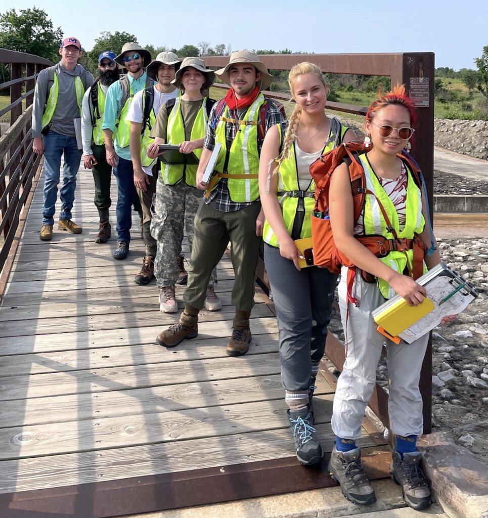
She also worked on a U.S. Geological Survey research project for GGE professor Jennifer Gifford. Five students helped map out a small section of the Big Horn Mountains – at a dizzying height of 9,000 feet and higher.
Elsie is from Oxford, MS. She’s a junior, majoring in Geology and participating in the Sally McDonnell Barksdale Honors College.
Geohazards Expert to Lead Geological Engineering Department
Thomas Oommen brings more than 10 years of experience in research and academia
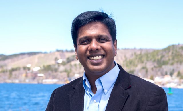
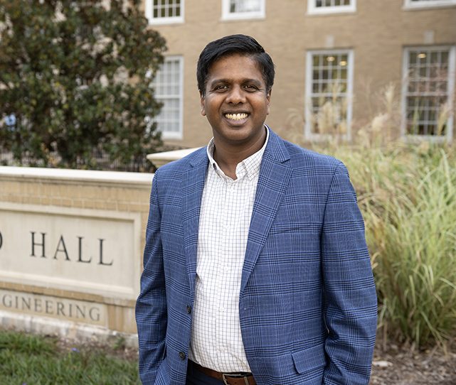
Thomas Oommen is joining the School of Engineering as chair of its Department of Geology and Geological Engineering. He comes to Ole Miss from Michigan Technological University, where he has been a faculty member for more than 10 years. Submitted photo
OXFORD, Miss. – Thomas Oommen, an expert in geohazard risk assessment, is slated to join the University of Mississippi School of Engineering as chair of its Department of Geology and Geological Engineering.
“I believe in the immense potential of the department, and I am committed to creating a positive and supportive environment for all the members,” said Oommen, who is coming to Ole Miss after spending more than a decade at Michigan Technological University.
“As the department chair, I will prioritize academic excellence, promote scholarly research and foster a culture of collaboration and innovation.”
At Michigan Tech, Oommen is a professor in the Department of Geological and Mining Engineering and Sciences and the director of its computational science and engineering doctoral program.
His research interests include geohazard risk assessment and critical infrastructure system monitoring. He has adopted an interdisciplinary research approach that integrates geological engineering concepts with tools from two main areas: remote sensing for obtaining data and artificial intelligence and machine learning for data processing and modeling.
He has received more than $10.5 million in research and travel grants for his work. One of his recent projects, funded by the National Science Foundation, is designed to help develop tools that rural counties can use to enhance flooding and coastal disaster resilience.
He also has received a grant from the Federal Railroad Administration to create an automated decision support system to monitor ground hazard risks such as landslides.
His ambitions extend to the geology and geological engineering department.
“I aim to enhance the department’s reputation and visibility by cultivating research partnerships with other institutions, organizations and industries,” he said. “I am eager to showcase the accomplishments of the department’s members to a broader audience and raise awareness of the department’s contributions to the field.”
Oommen has led Michigan Tech’s computational science and engineering doctoral program since 2019. Since, he has significantly grown the program – leveraging the available resources and attracting new faculty to participate in the interdisciplinary program. He also has mentored several students in pursuing prestigious fellowships.
“To drive a successful graduate program, it is important to have funded research projects and it is equally important to mentor students to apply for competitive fellowship programs like the NSF graduate research fellowship, NASA’s FINESST program, the Department of Defense’s SMART fellowship and more,” he said.
Oommen received his doctorate in civil and environmental engineering from Tufts University with an emphasis in geotechnical engineering. Before that, he obtained a master’s in geological engineering department of the University of Alaska at Fairbanks and his bachelor’s in engineering from Bangalore University.
He joins the School of Engineering team in August. Gregg Davidson, who has been the department chair since 2013, will return to full-time faculty status.
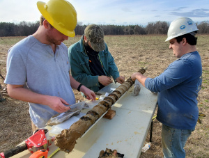
Drilling Down on a Win-Win Collaboration
Mississippi Mineral Resources Institute assists Profile Products in mining, gathering data
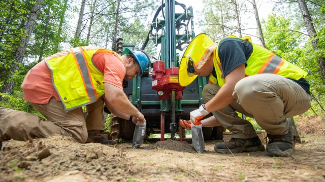
UM graduate student Kristian Macis (right) and Lance Yarbrough, associate professor of geology and geological engineering, collect auger cuttings from the Porters Creek Formation in Tippah County for laboratory analysis. Photo by Kevin Bain/Ole Miss Digital Imaging Services
OXFORD, Miss. – A joint research drilling project between the Mississippi Mineral Resources Institute at the University of Mississippi and a northeast Mississippi mining company is producing benefits for both partners.
MMRI and Profile Products in Blue Mountain are in the middle of the ongoing project, which began in May. Profile Products mines the clays of the Porters Creek Formation in Tippah County and produces products used to construct and maintain athletics fields across the country.
Researchers and students at MMRI and the UM Department of Geology and Geological Engineering are drilling a series of test holes on property leased by the company.
Lance Yarbrough, UM associate professor of geology and geological engineering, uses a Munsell chart to record the correct color of clays observed in the field. Photo by Kevin Bain/Ole Miss Digital Imaging Services
“The project is an ideal opportunity for both Profile Products and the University of Mississippi to collect important research data,” said Greg Easson, MMRI director and professor of geology and geological engineering.
“The UM research team was provided access to an ideal site to conduct a drilling campaign that can be used to validate geophysical methods for subsurface characterization. In addition, the team gets samples of the clay for a geological analysis of its character and origin.
“Meanwhile, Profile Products acquires the data they need to determine the amount of clay reserves on the property and samples for testing in their in-house lab to maintain consistency in the products they produce.”
The team is using a drill rig purchased with funds provided by the Mississippi Legislature through a grant program from the Mississippi Board of Licensure for Professional Engineers and Surveyors. During the drilling process, data are collected from the layers of clay being mined and continue through the different types of soil underneath the earth’s surface.
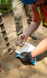
Subsurface samples collected are divided in the field, with half of them provided to Profile Products for testing in its lab to see if the material meets its specifications.
The other half of the samples for each depth will be retained and analyzed by the UM research team to help understand the geological history and origin of this geological formation. Findings will form the core of an Ole Miss graduate student’s thesis.
As part of the research team is drilling, other researchers and students are collecting geophysical data along the same path. The methods for collecting geophysical data include ground-penetrating radar, electrical resistivity and passive seismic (the detection of natural, low-frequency earth movements).
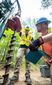
Geological engineering professor Lance Yarbrough (right) and second-year graduate student Kristian Macis auger a borehole in Tippah County. Photo by Kevin Bain/Ole Miss Digital Imaging Services
Data collected using these methods will be compared to the drilling data to determine the accuracy of the geophysical methods.
“Profile Products has agreed to provide the UM team access to the site so that we can process the data, reconfigure the systems and collect another set of data,” Easson said. “This research will provide the UM research team with validation of the level of accuracy of the geophysical data to show how these methods can be used in areas where drilling is not allowed, such as levees on the Mississippi River.”
The partnership between the company and MMRI is mutually beneficial, said Chas Goff, plant manager at Profile Products.
“The reserve data will allow Profile Products to expand our operations,” Goff said. “The students are learning how to drill safely and how to sample and work with clients.”
The drilling and reserve estimate for the project will be completed by the end of July, with analysis and additional geophysical data collection continuing into September.
In Memoriam: JULIUS M. RIDGEWAY (1933 – 2021)
It is with deep regret and profound sadness that we inform you that Julius Ridgeway passed away this past Sunday, May 30. A great friend of our department who had a distinguished career and gave back in many ways to our program, including serving on many graduate student committees. He will be sincerely missed.
![]()
Geoscience Workforce Projections 2019-2029 : UP 4.9%
Employment projections from the U.S. Bureau of Labor Statistics (BLS) indicate an overall 4.9% increase in geoscience jobs between 2019 and 2029, from 460,242 jobs in 2019 to 482,726 jobs in 2029. For comparison, the projected growth of the U.S. workforce over the same timeframe is expected to be 3.7%. While growth rates for individual geoscience occupations range between 0% and 8.4% for all but geoscience engineering managers (-1%), those occupations projected to gain the greatest number of jobs are environmental scientists (7,100 jobs), environmental science technicians (2,900 jobs), and environmental engineers (1,800 jobs).
Who Needs a Geoscientist?
Enjoy this very interesting article at: Who Needs Geoscientists?
GGE Virtual Graduation Ceremony – hosted by Dr. Davidson
Congratulation to all the geologists and geological engineers of the 2020 class!
Check out the video with cameo appearances from all of our 2020 graduates.
 Dean Dave Puleo on how the school is meeting the coronavirus challenges
Coronavirus, COVID-19, uncharted territory, social distancing, flatten the curve, course conversion, Zoom meetings. These words are now forever ingrained in our vocabulary. Our Engineering community has been tremendous during these trying times….
April 2020
 Ole Miss geological engineering students learn about geologic mapping
The Mississippi Mineral Resources Institute (MMRI) and Department of Geology and Geological Engineering at Ole Miss are undertaking a geologic mapping and drilling project in Charleston, Mississippi – that’ll help identify economic resources and contribute to scientific research in the region.
February 2020
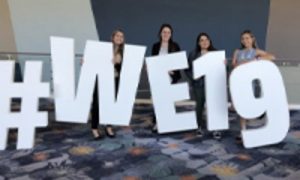 Society of Women Engineers achieving its goal at Ole Miss: helping female engineers succeed

Four Ole Miss students attended the national SWE conference in California last month – and three walked away with job offers. And, SWE events on campus give students the opportunity to hear from alumnae what it’s like to transition from college to the workplace. Read more…
December 2019
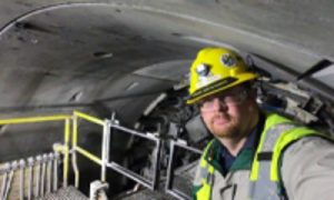 Geology professor assists construction in Delaware Aqueduct Bypass Project
Lance Yarbrough, assistant professor of geology and geological engineering at Ole Miss, spent much of his summer 600 feet below the Hudson River. He was working on a project to build a 2.5-mile-long bypass tunnel for the Delaware Aqueduct, which provides about half of New York City’s water. Read more…
November 2019
 Dr. Brian Platt
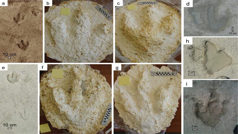
Assistant Professor of Geological Engineering Leads Dinosaur Track Preservation Project.
 Helpful info
Ole Miss Engineer – our annual round-up of school and department highlights